
Mount Meru facts
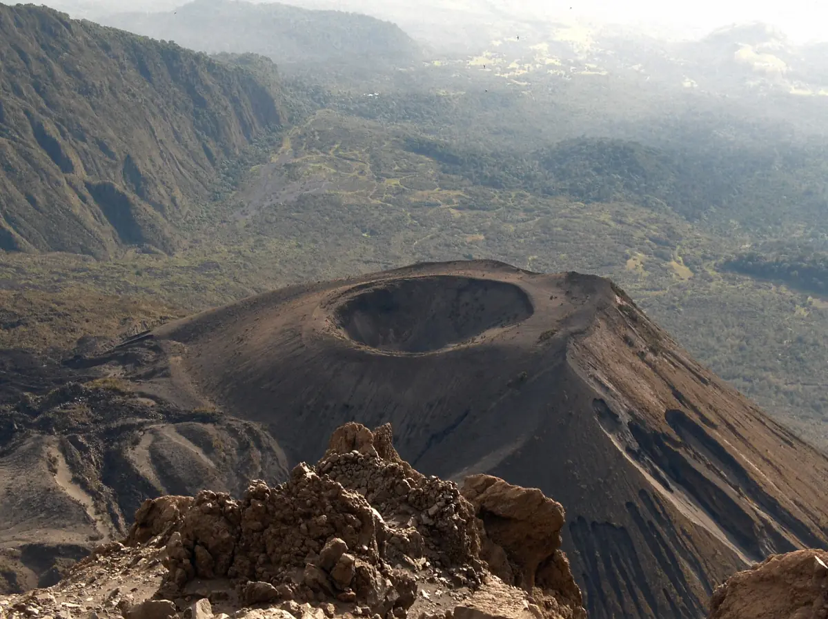
Mount Meru is a stratovolcano in Arusha National Park. Its summit is called Socialist Peak. The volcano has a collapse crater that opens to the east, and inside that crater sits a young cone, the Ash Cone. From Arusha city the mountain fills the skyline on clear mornings.
Meru is the second highest mountain in Tanzania, after Kilimanjaro. Meru is a mountain in its own right, not a part of Kilimanjaro, and the two are a few hours apart by road. Visitors usually meet Meru in one of two ways: as a backdrop on a day trip through the park, or on a multi-day climb that starts at Momella Gate.
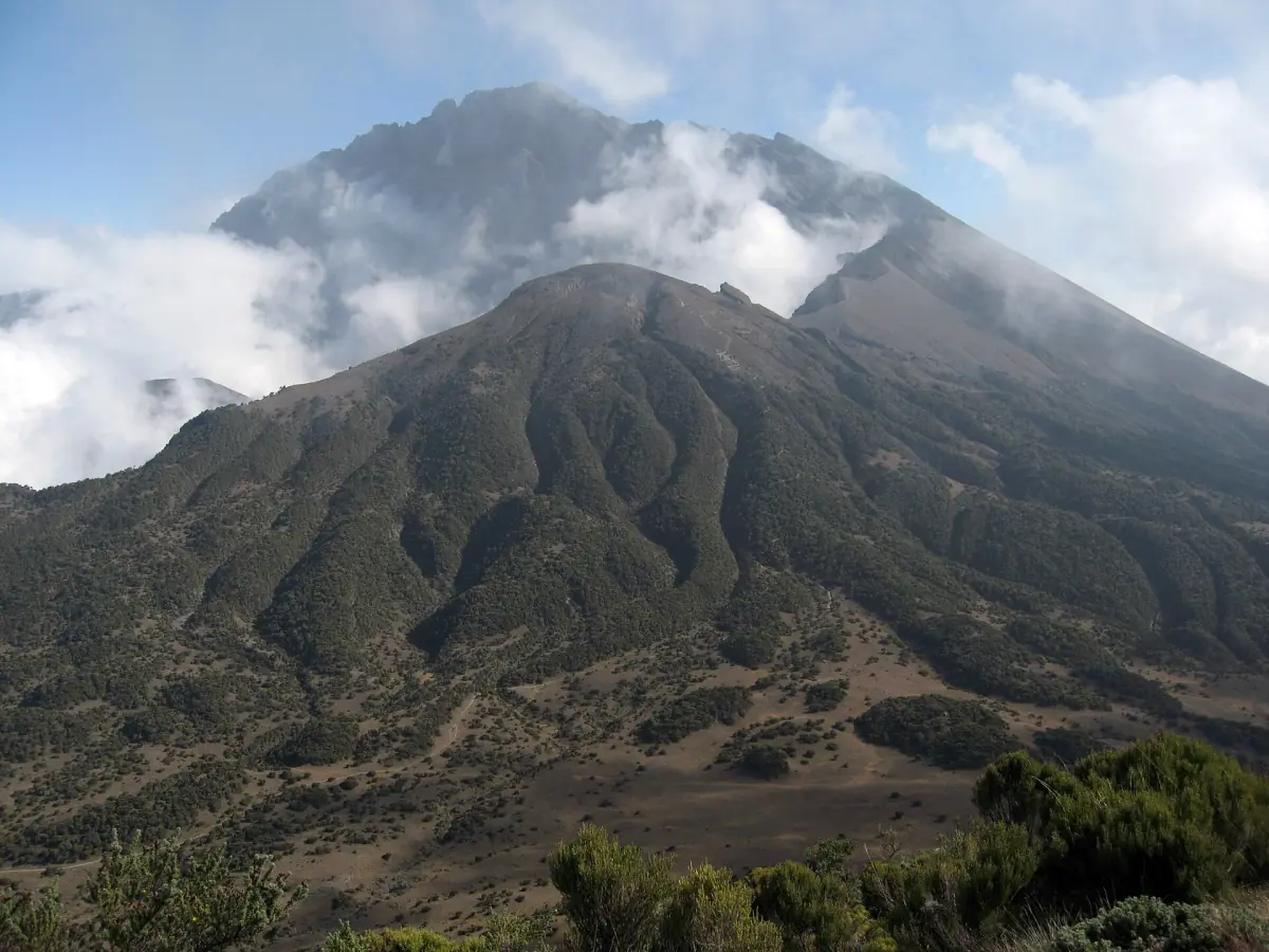
Mount Meru height
About 4,565 m, a little over 4,500 m.
Mount Meru reaches about 4,565 m. Small differences between measurements come from rounding and measuring methods, so "about 4,565 m" or "a little over 4,500 m" is the safe way to say it.
Rankings across Africa depend on the definition, so this guide sticks to the rank that holds: Meru is the second highest mountain in Tanzania.
Our pick: a Mount Meru group trek
A four-day trek with park fees and huts included, for readers who want to climb the volcano.
Hand-picked tours, booked through GetYourGuide. Prices are indicative starting prices in US dollars (as of October 2026). Tap a tour for live availability and the current price in your currency.
Mount Meru and Arusha National Park tours
Safari day trips, walks and Mount Meru trips with live prices and availability.
Mount Meru Tanzania: crater and Ash Cone
What the volcano looks like from inside and above.
Meru's summit sits on the rim of a crater about 4 km wide that opens to the east. The Ash Cone formed inside it. It has a small crater of its own, which you can see in photographs taken from the rim. The shape of the mountain is the result of an old collapse of the eastern side of the volcano.
The last documented eruption ran from 26 October to 22 December 1910 and built activity at the Ash Cone. That is the last known ash eruption. It does not mean the volcano is extinct. If you plan a climb, follow the instructions of the ranger who accompanies you.
Do not mix up Meru's crater with the Ngurdoto Crater. Ngurdoto is a separate, forested crater lower in the park. See the Ngurdoto Crater page.
How visitors meet the mountain
Three ways, from easy to demanding.
From the park roads
On a game drive you see Meru above the forest and the Momella Lakes. It is the simplest way to see the volcano and needs no climbing.
Arusha safari →From Arusha city
In town the mountain rises behind the buildings and trees. You do not need a ticket for that view.
Arusha city guide →On the climb
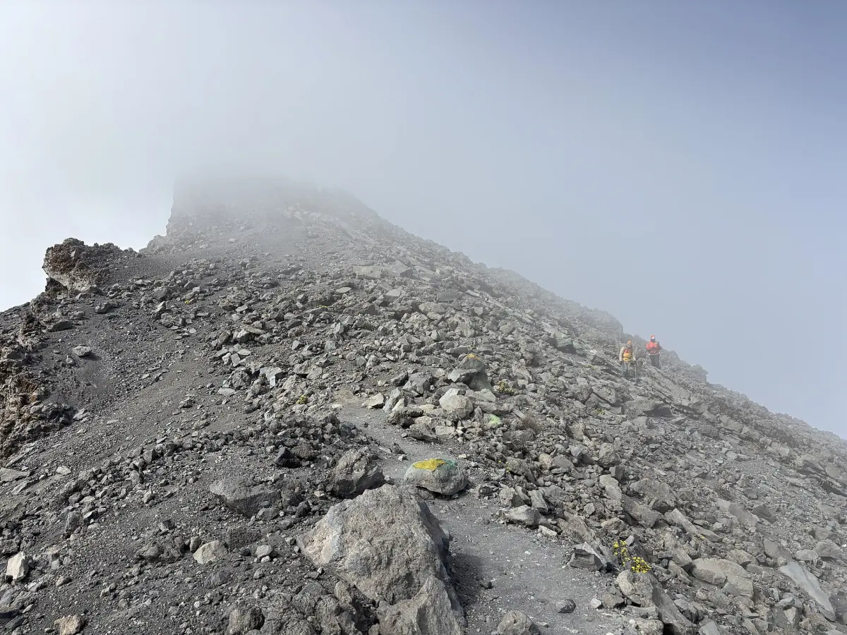
The climb starts at Momella Gate and uses two huts, Miriakamba Hut and Saddle Hut, with an armed ranger. It takes several days.
Mount Meru climb →Many travelers who plan Kilimanjaro treat Meru as preparation. Meru is a good rehearsal for the bigger mountain. If that is your plan, read the guide to the Kilimanjaro climb as well. The right choice depends on your time and fitness, so for most visitors on a short trip, the park roads and the viewpoints are the better start.
Mount Meru: frequently asked questions
How high is Mount Meru?
About 4,565 m, or a little over 4,500 m. Use one of these rather than a figure to the metre.
Is Mount Meru an active volcano?
Its last known ash eruption was in 1910. That does not mean it is extinct. Follow ranger instructions on the mountain.
What is the highest point called?
The summit is called Socialist Peak.
Is Mount Meru the second highest mountain in Tanzania?
Yes, after Kilimanjaro.
Is the Ngurdoto Crater the same as the Meru crater?
No. The Meru crater is the collapse crater on the volcano. Ngurdoto is a separate crater lower in the park. See Ngurdoto Crater.